Have you ever wondered how fresh are these Google Earth images? Google Earth gives a 3D image of the Earth by combining all the images received from the satellites. This product was formerly called Keyhole Earth Viewer.
In this article, we have given a detailed explanation of what is Google Earth software and how often is Google Earth updated?
Don’t want to miss the best from TechLatest?
Set us as a preferred source in Google Search
and make sure you never miss our latest.
What is Google Earth?
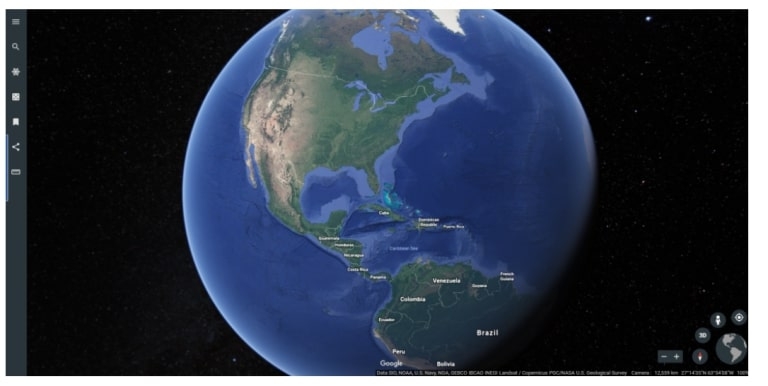
Google Earth gives a 3D representation of Earth. You can either spin the globe and select the location manually or you can input the location details and coordinates to get the images.
Often, people get confused between Google Earth and Google Maps. These two are different products altogether. In Google Earth, you can find the weather data, road markings, etc., where all the mapping tools are integrated. One can also get the flat view and 3D view of the images to get a beautiful experience of cities.
Currently, Google Earth is available for the desktop and browsers. The desktop version is called Google Earth Pro.
How Often Is Google Earth Updated?
Google Earth is updated once a month, as per the official blog of Google. However, not all images on Google Earth are updated every month, and sometimes it might take more delay to update the database.
Since Google collects the imagery from multiple third-party sources, you might find a delay in the image updation. Google does not update all the images and other factors in one go. Here are some of the main factors of Google Earth:
Areas and Location
Updating the urban areas frequently makes more sense than updating the maps of the rural areas. This is because urban areas tend to change rapidly compared to rural areas, and Google has to be updated with the change.
To speed up the process of updating, Google takes the images from the third-party applications and updates them on Google Earth. Hence, you can find that high-dense areas are quickly updated on Google Earth compared to rural ones.
Weather
Updating the areas where always snow is covered or clouds are covered does not make sense. This is because Google cannot always get clear shots of the places. If Google has to take high-resolution images of such locations, it involves a lot of cost and time to capture them.
Security
Some confidential locations like military bases, and government locations, will not be updated on Google Earth due to the personal request from the lawsuits as well as the governments. Hence, you can see them blacked out on Google Earth.
Not only government-related areas but also areas where criminal activities are high, and the areas which are marked as the no-fly zone will not be captured by Google Earth.
Time and Money
If you are able to zoom in and see a clear picture of vehicles, then it is the work of aerial photography. To get such clear pictures, Google has to shell out money. Also, Google takes image sources from multiple third-party companies, and that as well is expensive.
Not only for clicking the pictures but also editing and uploading on the Google platform costs money.
Frequently Asked Questions
Why Does Google Not Update the Google Earth Images Continuously?
As mentioned above, Google Earth depends on multiple sources and third-party companies for the images and other data. Hence, it takes a lot of time to update the Google Earth images. Also, there is a rule in Google that no map should be older than 3 years. So, you can find the images updated on Google Earth are less than 3 years old.
Can we Manually Request an Update to Google Earth Images?
Yes, you can manually request an update to the Google Earth images with the help of the feedback tool. Firstly, navigate to the location which you want to get updated on Google Earth.
On the desktop version, you need to navigate to the help section and from there, go to the ‘Send Feedback’ option. On the browser version, go to the three horizontal lines and click on the ‘Feedback’ option.
Now, in the text field, select the option ‘I would like to recommend imagery refresh.’
Though the request will be made from the user end, Google has to check if there are any latest images available for that location from third-party sources and also consider the weather conditions over there.
What does Google Earth Specifically Update?
Google Earth updates the map in bits and pieces. As discussed above, the update will be for a few cities first and then goes on to the rural areas. Once Google releases the list of updated locations, it also releases the KML file along with it. All the updated regions are marked red in the KML file.
Conclusion
Now that you know how Google Earth works, you might have got a fair understanding of how often it gets updated as well. In short, Google updates the locations anywhere between one month to three years. There won’t be any location that is outdated beyond three years.
Enjoyed this article?
If TechLatest has helped you, consider supporting us with a one-time tip on Ko-fi. Every contribution keeps our work free and independent.
Support on Ko-fiDirectly in Your Inbox

")